Objective: Development of an R / R Shiny platform to investigate historic maritime exploration.
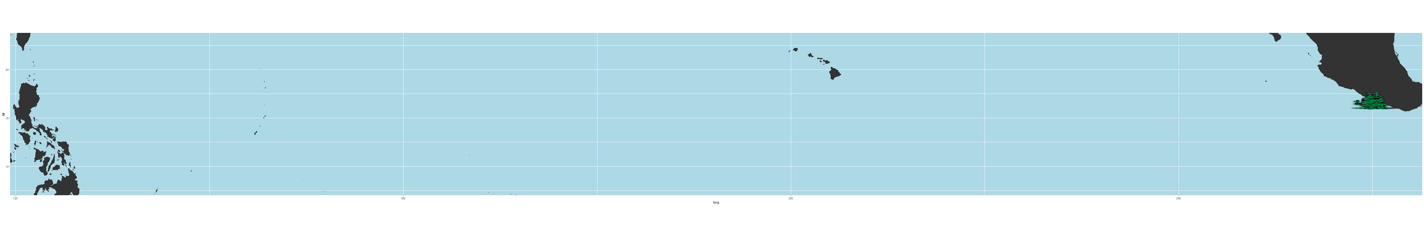
Building upon work focused on models of Polynesian exploration and settlement during pre-colonial times, this R project integrates environmental and paleoenvironmental data from a variety of sources to create an agent-based simulation of maritime exploration. Canoe and navigation strategies comes from historic and indigenous knowledge.
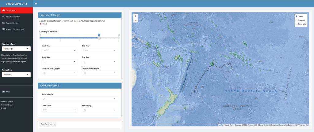
Data Sources
- Winds – NCEP daily wind data (1948-2020)
- Currents – OSCAR 1/3 degree current data in 5 day cycle
- Land – Natural Earth 10m vector
- Vessels – This sets the leeward drift profile and performance as described by the USCG (2013:440-443) profiles
Bibliography
Davies, B. and S. Bickler, 2015. Sailing the simulated seas: a new simulation for evaluating prehistoric seafaring. In Across Space and Time: Computer Applications and Quantitative Methods in Archaeology CAA. Proceedings of the 41st International Conference, Perth, WA, Australia, March 25 – 28, 2013. Amsterdam: Amsterdam University Press.
United States Coast Guard, 2013. U.S. Coast Guard Addendum to the United States National Search and Rescue Supplement (NSS) to the International Aeronautical and Maritime Search and Rescue Manual (IAMSAR). COMDTINST M16130.2F.
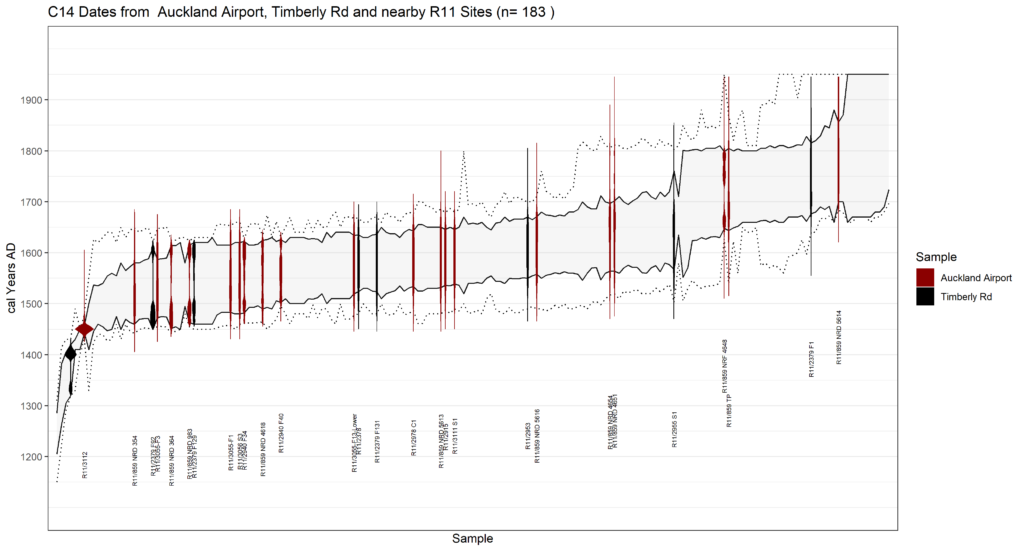
Radiocarbon Dating Chart
Development of a flexible specialised graph in R (ggplot) for integrating large numbers of radiocarbon dates from Aotearoa New Zealand and Rapa Nui (Easter Island). The graph highlights specific groups of dates (e.g., from a single site) showing the calibration probability curves over a summary of selected range of dates such as from a geographic region. Scaled to a R Shiny application with site location maps.